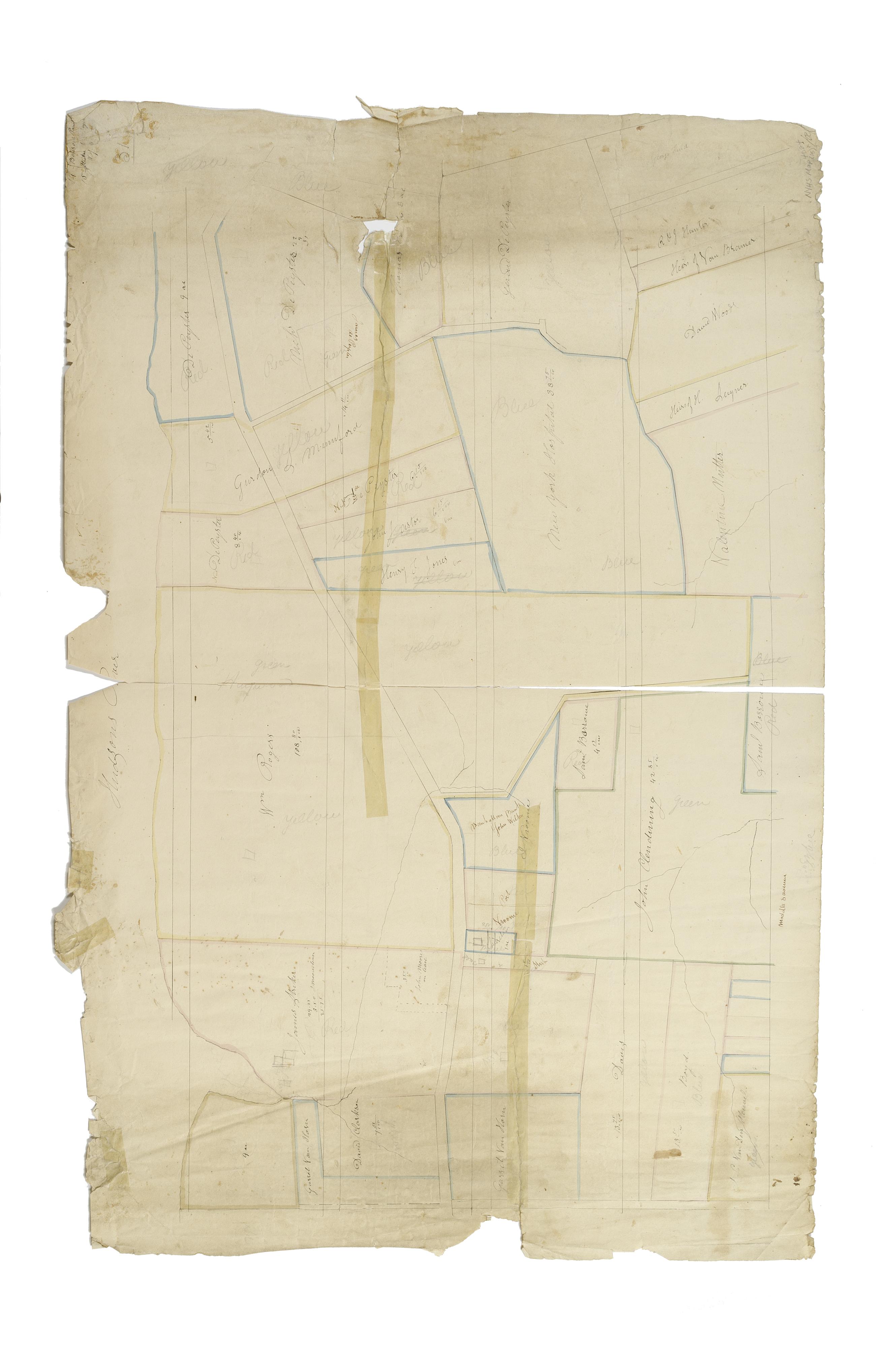
Still Image [Map of the area later bounded by 113th and 136th Streets, Park Avenue and Douglas Boulevard, Manhattan, New York, N.Y.]. Scale [ca. 1:2,450]. Cadastral map. Shows property lines and owners' names, some existing roads and projected streets. Shows relief by hachures. Pen-and-ink, watercolor on paper. Imperfect: lacking 15 cm. square at bottom center. Annotations in a later hand on the recto of this sheet give the number 17. The map on recto of this sheet belongs to the same series and is separately cataloged under the title, [Map of the area later bounded by 114th and 137th Streets, the Harlem River and 5th Avenue, Manhattan, New York, N.Y.]. View Item
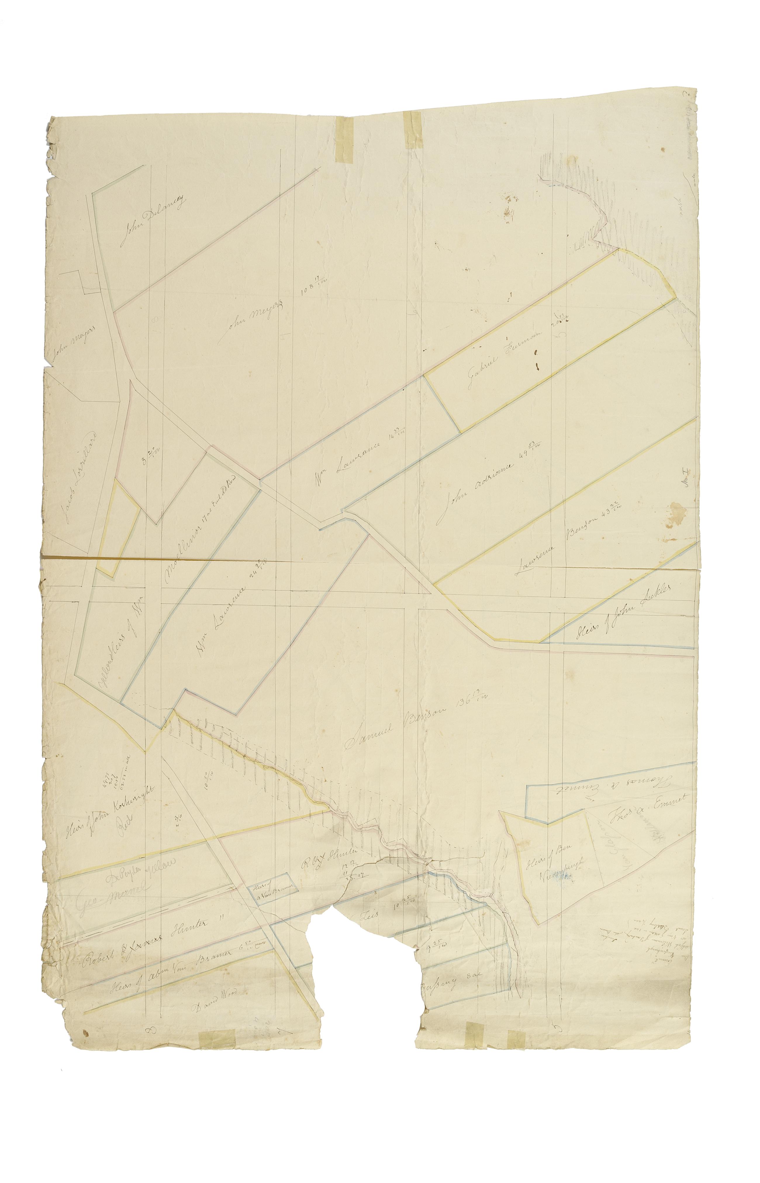
Still Image [Map of the area later bounded by 93rd and 118th Streets, Central Park West or Douglass Boulevard, and the Hudson River, Manhattan, New York, N.Y.]. Scale [ca. 1:2,450]. Cadastral map. Shows property lines and owners' names, some existing roads and projected streets. Pen-and-ink, watercolor on paper. Annotations in a later hand on the recto of this sheet give the number 15. The map on verso of this one belongs to the same series and is separately cataloged under the title, [Map of the area later bounded by 93rd and 115th Streets, the East or Harlem River and Park Avenue, Manhattan, New York, N.Y.]. View Item