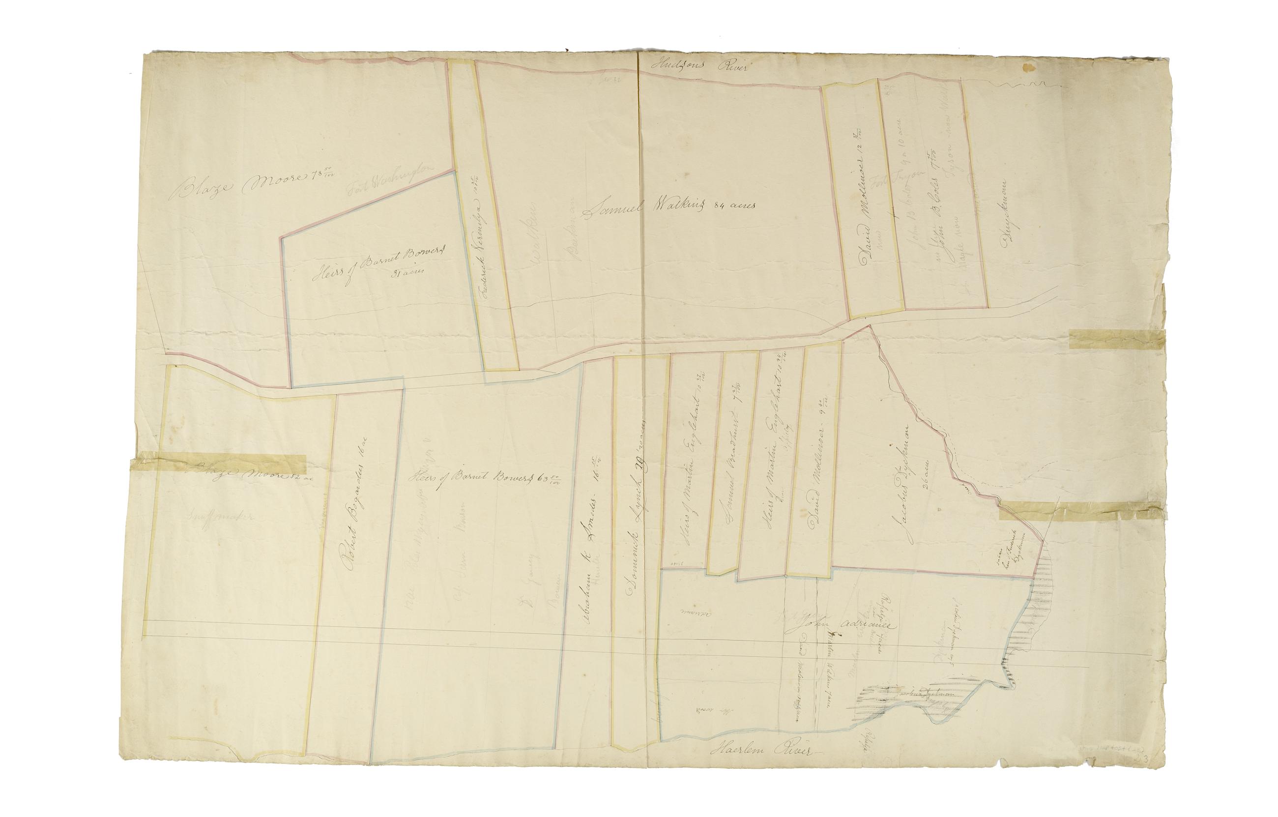
Still Image [Map of the area later bounded by 129th and 158th Streets, Douglass Boulevard and the Hudson River, Manhattan, New York, N.Y.]. Scale [ca. 1:2,450]. Cadastral map. Shows property lines and owners' names, some existing roads and projected streets. Shows relief by hachures. Pen-and-ink, watercolor on paper. Annotations in a later hand on the recto of this sheet also give the number 21. The map on recto of this sheet belongs to the same series and is separately cataloged under the title, [Map of the area later bounded by 135th and 157th Streets, the Harlem River and Convent Avenue, Manhattan, New York, N.Y.]. View Item
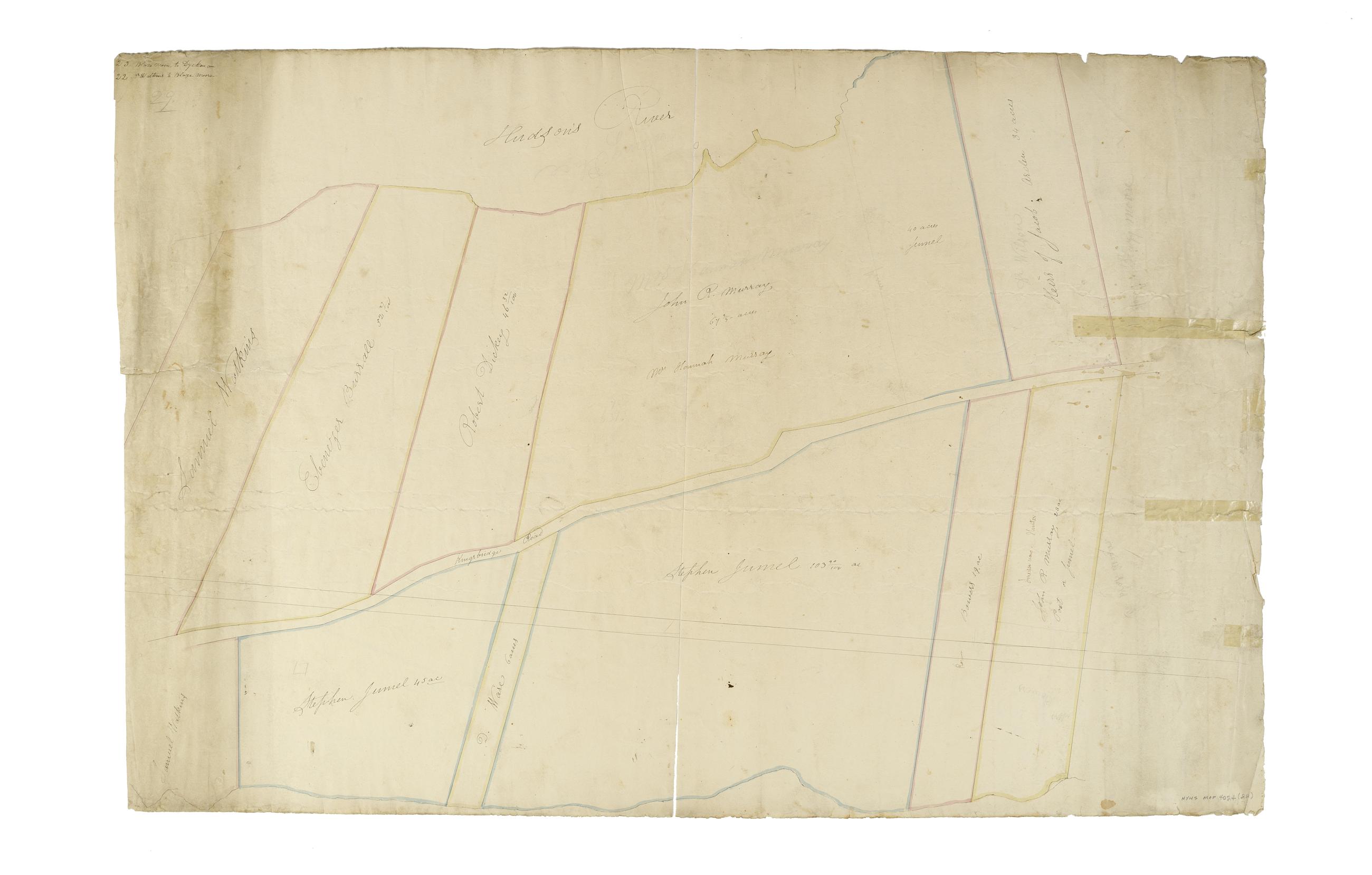
Still Image [Map of the area later bounded by 177th and 201st Streets, the Harlem and Hudson Rivers, Manhattan, New York, N.Y.]. Scale [ca. 1:2,450]. Cadastral map. Shows property lines and owners' names, some existing roads and projected streets. Shows relief by hachures. Pen-and-ink, watercolor on paper. Annotations in a later hand on the recto of this sheet give the number 23. The map on recto of this sheet belongs to the same series and is separately cataloged under the title, [Map of the area later bounded by 156th and 178th Streets, the Harlem and Hudson Rivers, Manhattan, New York, N.Y.]. View Item
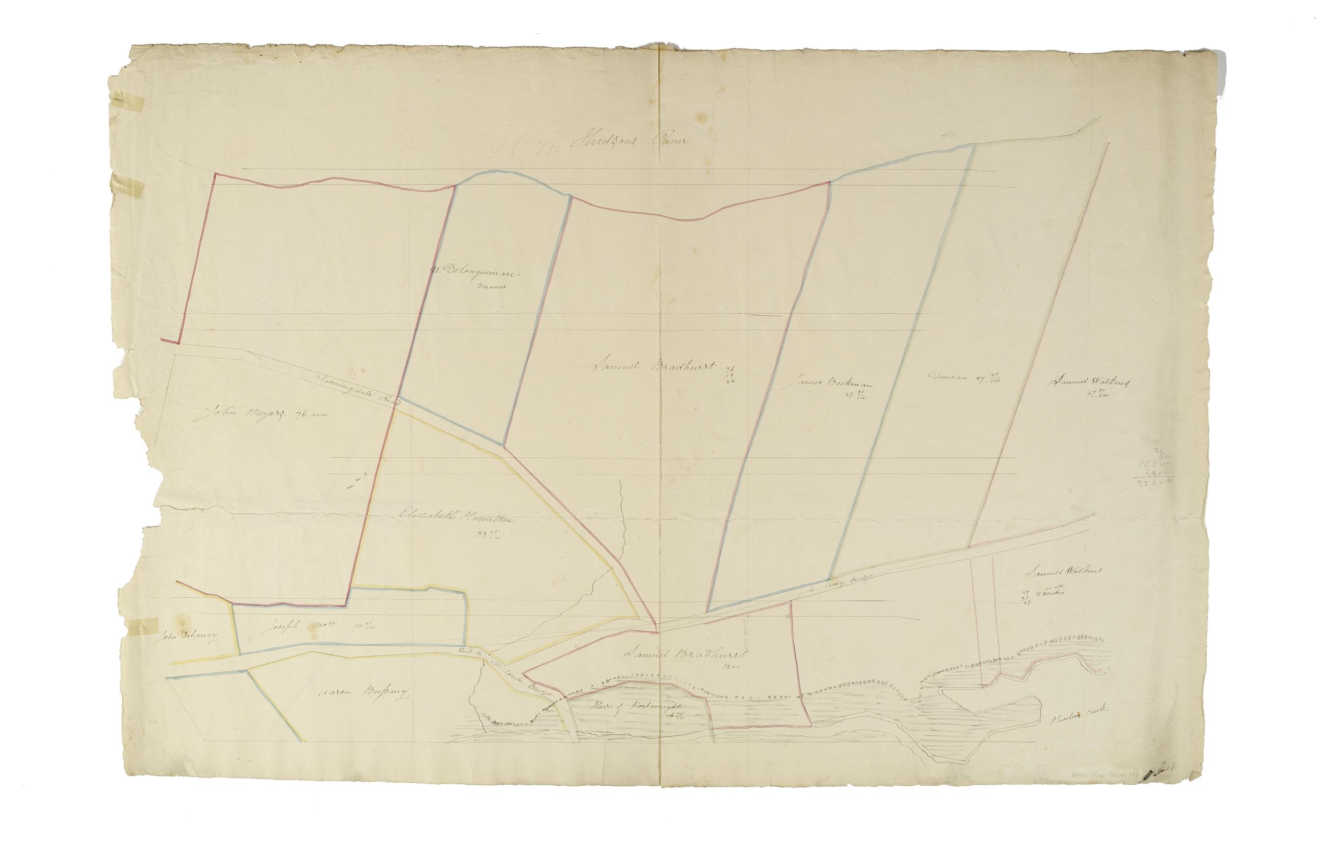
Still Image [Map of the area later bounded by 156th and 178th Streets, the Harlem and Hudson Rivers, Manhattan, New York, N.Y.]. Scale [ca. 1:2,450]. Cadastral map. Shows property lines and owners' names, some existing roads and projected streets. Shows relief by hachures. Pen-and-ink, watercolor on paper. Imperfect: lacking 15 cm. at bottom margin. Annotations in a later hand on the recto of this sheet give the number 22. The map on verso of this one belongs to the same series and is separately cataloged under the title, [Map of the area later bounded by 177th and 201st Streets, the Harlem and Hudson Rivers, Manhattan, New York, N.Y.]. View Item
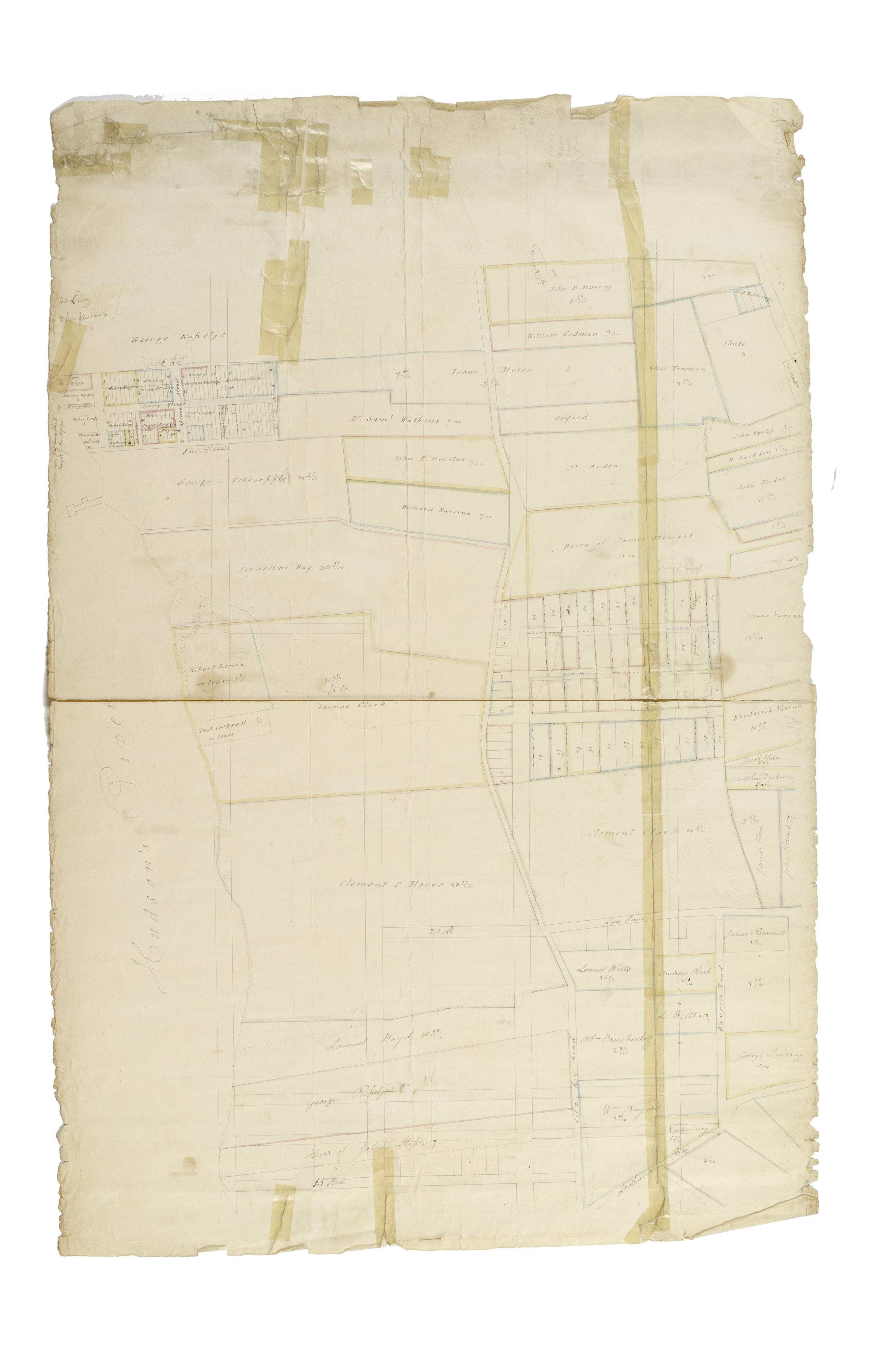
Still Image [Map of the area later bounded by 15th and 33rd Streets, 6th and 10th Avenues, Manhattan, New York, N.Y.]. Scale [ca. 1:2,450]. Cadastral map. Shows property lines and owners' names, some existing roads and projected streets. Shows relief by hachures. Pen-and-ink, watercolor on paper. Annotations in a later hand on the recto of this sheet also give the number 5. The map on recto of this sheet belongs to the same series and is separately cataloged under the title, [Map of the area later bounded by 52nd and 73rd Streets, the East River and Park Avenue, Manhattan, New York, N.Y.]. View Item