Still Image [Map of the area later bounded by 10th and 22nd Streets, 5th and 8th Avenues, Manhattan, New York, N.Y.]. Scale [ca. 1:2,450]. Cadastral map. Shows property lines and owners' names, some existing roads and projected streets. Shows relief by hachures. Pen-and-ink, watercolor on paper. Annotations in a later hand on the recto of this sheet give the number 2. The map on recto of this sheet belongs to the same series and is separately cataloged under the title, [Map of the area later bounded by 72nd and 95th Streets, the East River and Park Avenue, Manhattan, New York, N.Y.]. View Item
Still Image [Map of the area later bounded by 14th and 34th Streets, Park and 6th Avenues, Manhattan, New York, N.Y.]. Scale [ca. 1:2,450]. Cadastral map. Shows property lines and owners' names, some existing roads and projected streets. Pen-and-ink, watercolor on paper. View Item
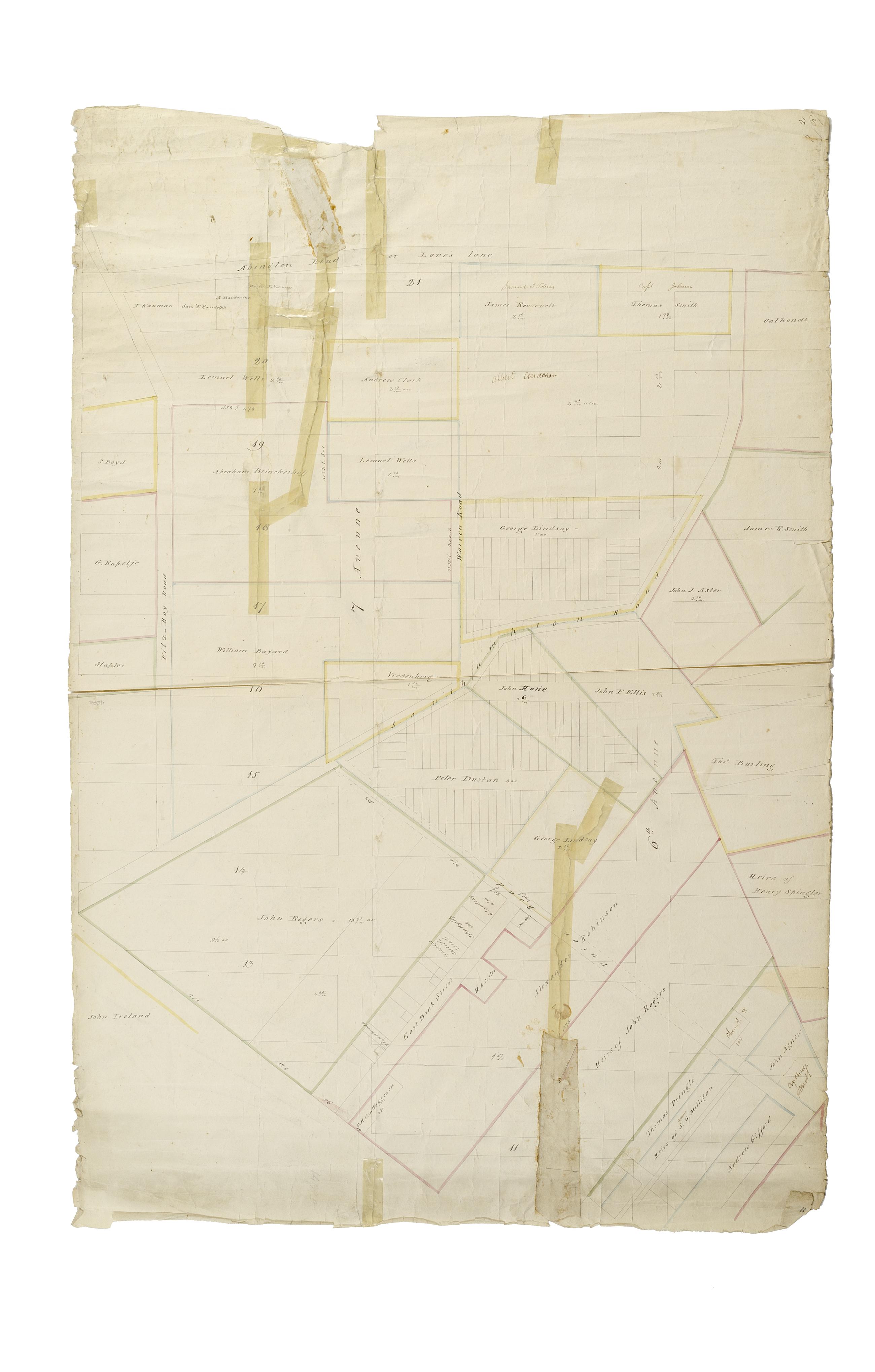
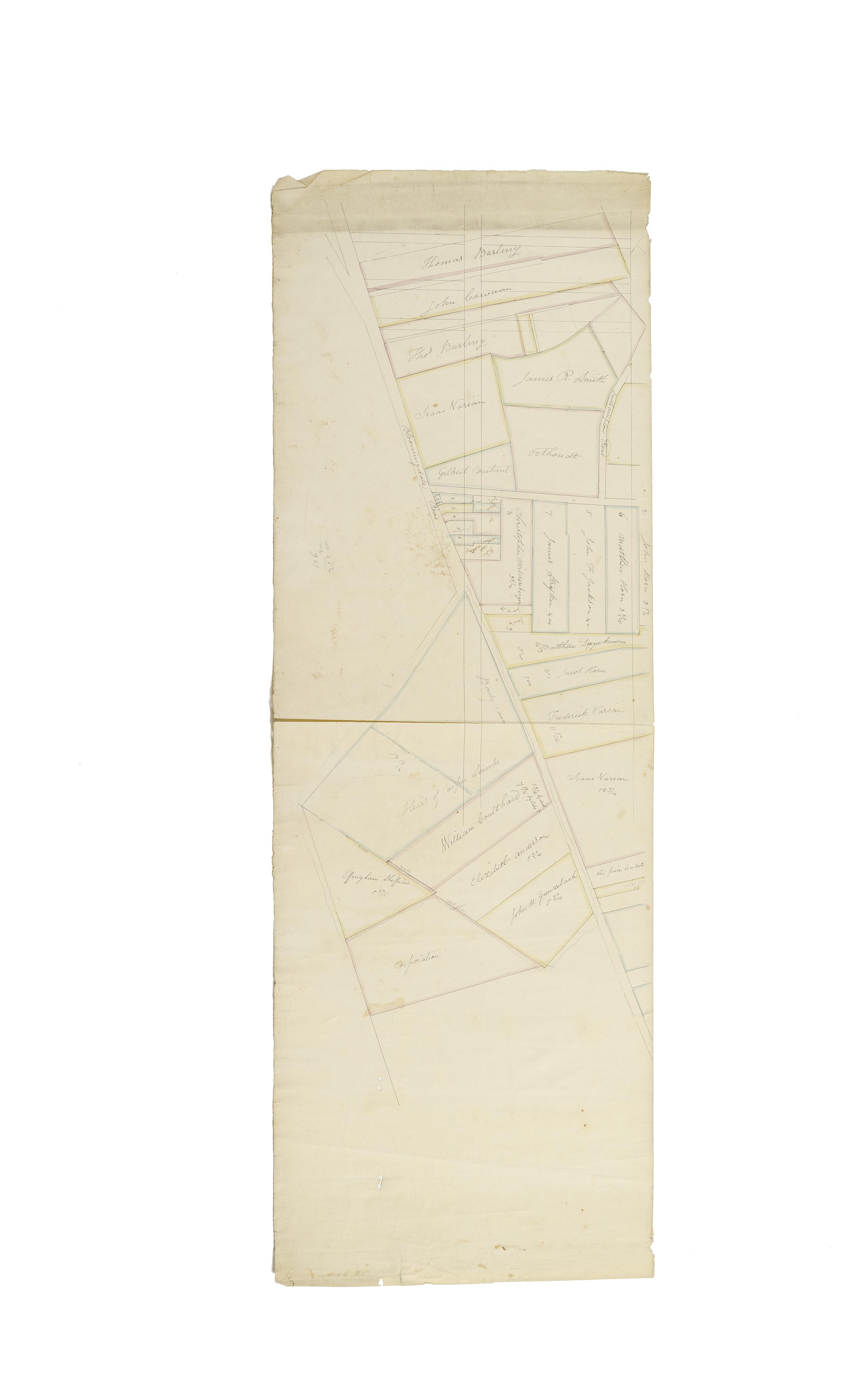
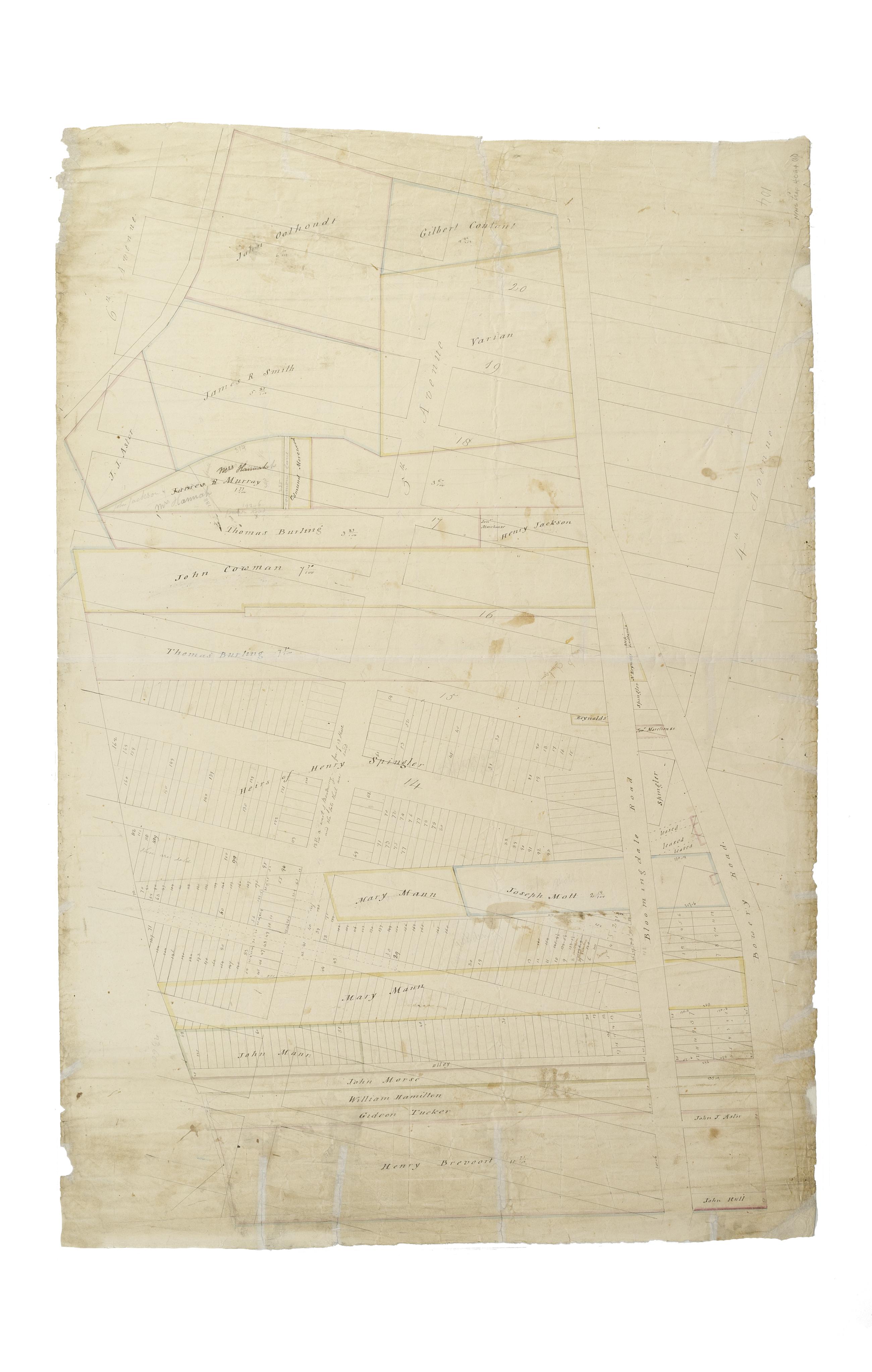
Still Image [Map of the area later bounded by 10th and 21st Streets, 3rd and 6th Avenues, Manhattan, New York, N.Y.]. Scale [ca. 1:2,450]. Cadastral map. Shows property lines and owners' names, some existing roads and projected streets. Shows relief by hachures. Pen-and-ink, watercolor on paper. Annotations in a later hand on the recto of this sheet give the number 1. The map on recto of this sheet belongs to the same series and is separately cataloged under the title, [Map of the area later bounded by 73rd and 94th Streets, Park Avenue and Central Park West, Manhattan, New York, N.Y.]. View Item