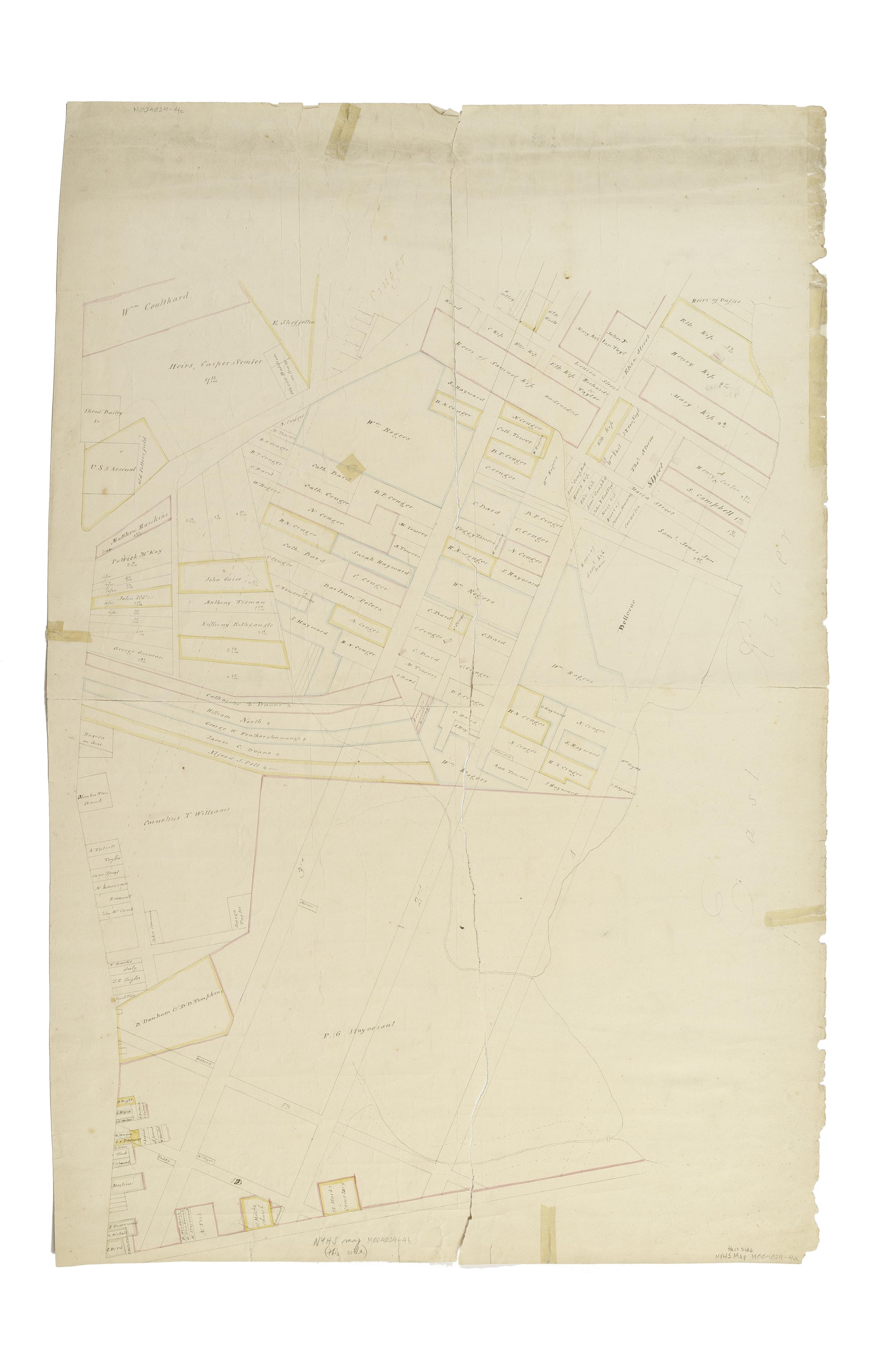
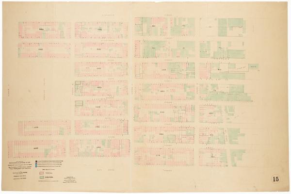
Still Image [Map of the area later bounded by 8th and 34th Streets, the East River and 5th Avenue, Manhattan, New York, N.Y.]. Scale [ca. 1:2,450]. Cadastral map. Shows property lines and owners' names, some existing roads and projected streets. Pen-and-ink, watercolor on paper. The map on verso of this one belongs to the same series and is separately cataloged under the title, [Map of the area later bounded by 52nd and 74th Streets, Park Avenue, and 8th Avenue or Central Park West, Manhattan, New York, N.Y.]. View Item
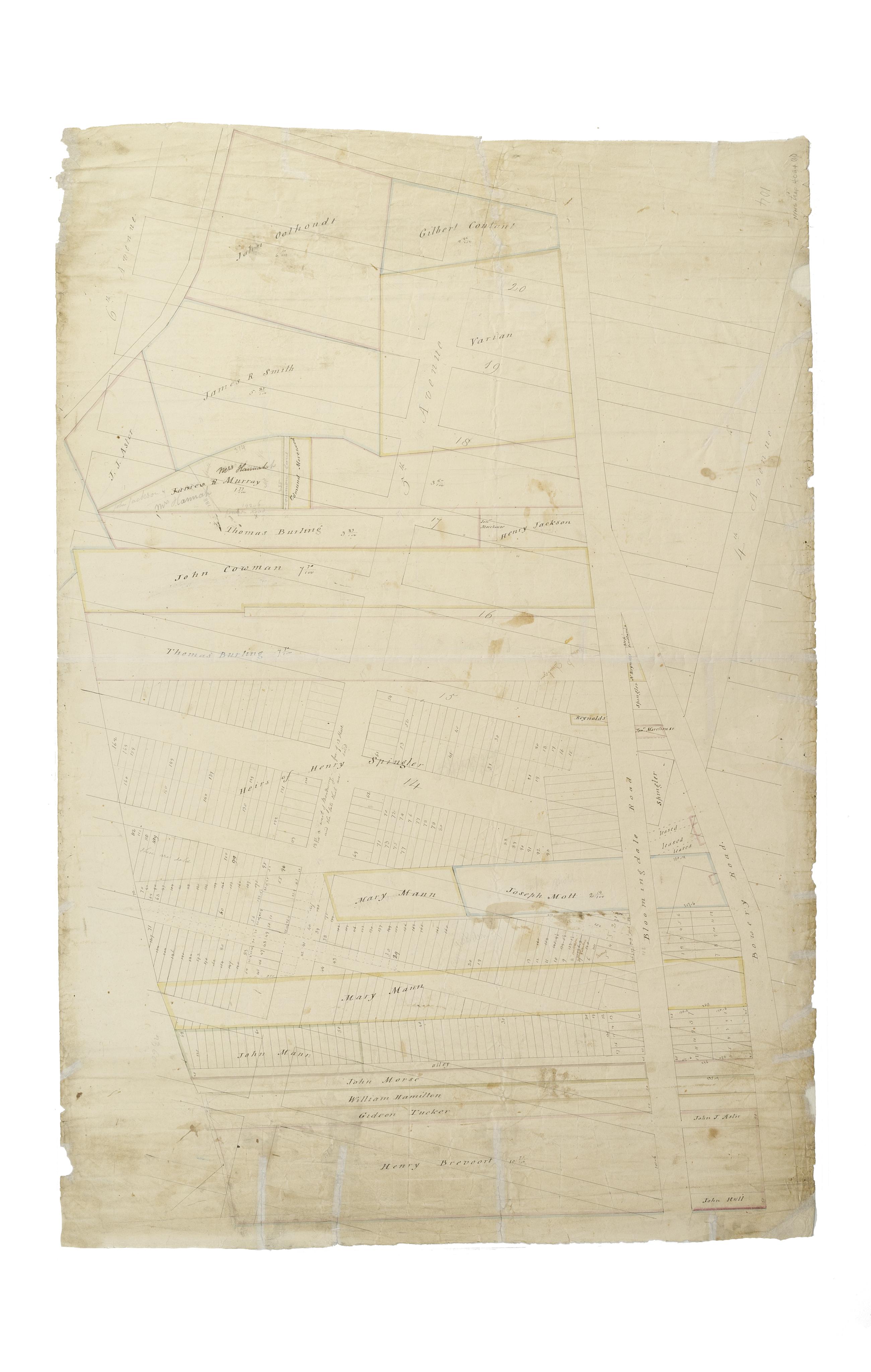
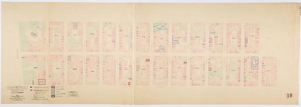
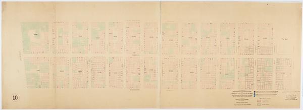
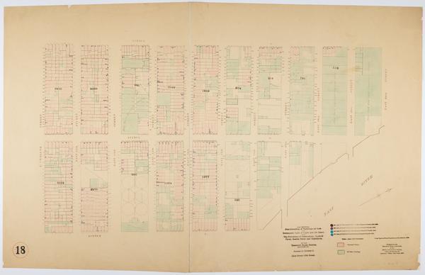
Still Image [Map of the area later bounded by 10th and 22nd Streets, 5th and 8th Avenues, Manhattan, New York, N.Y.]. Scale [ca. 1:2,450]. Cadastral map. Shows property lines and owners' names, some existing roads and projected streets. Shows relief by hachures. Pen-and-ink, watercolor on paper. Annotations in a later hand on the recto of this sheet give the number 2. The map on recto of this sheet belongs to the same series and is separately cataloged under the title, [Map of the area later bounded by 72nd and 95th Streets, the East River and Park Avenue, Manhattan, New York, N.Y.]. View Item
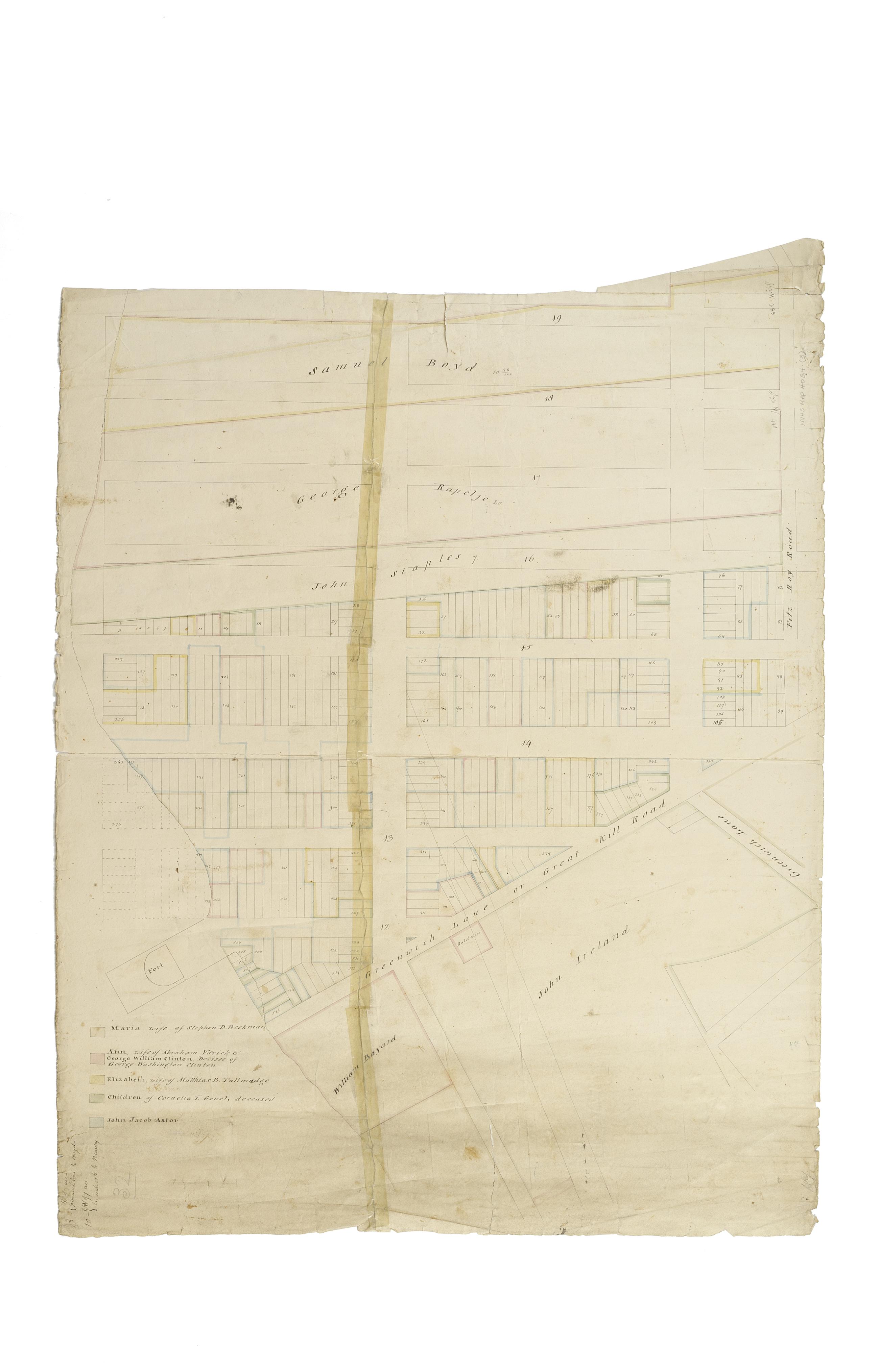
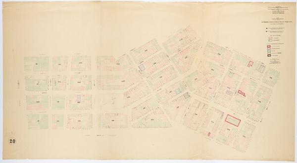
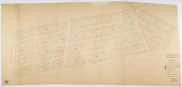
Still Image [Map of the area later bounded by 8th and 20th Streets, 7th Avenue and the Hudson River, Manhattan, New York, N.Y]. Scale [ca. 1:2,450]. Cadastral map. Shows property lines and owners' names, some existing roads and projected streets. Shows relief by hachures. Pen-and-ink, watercolor on paper. Annotations in a later hand on the recto of this sheet give the number 3. The map on verso of this one belongs to the same series and is separately cataloged under the title, [Map of the area later bounded by 56th and 78th Streets, 7th Avenue or Central Park, and the Hudson River, Manhattan, New York, N.Y.]. View Item
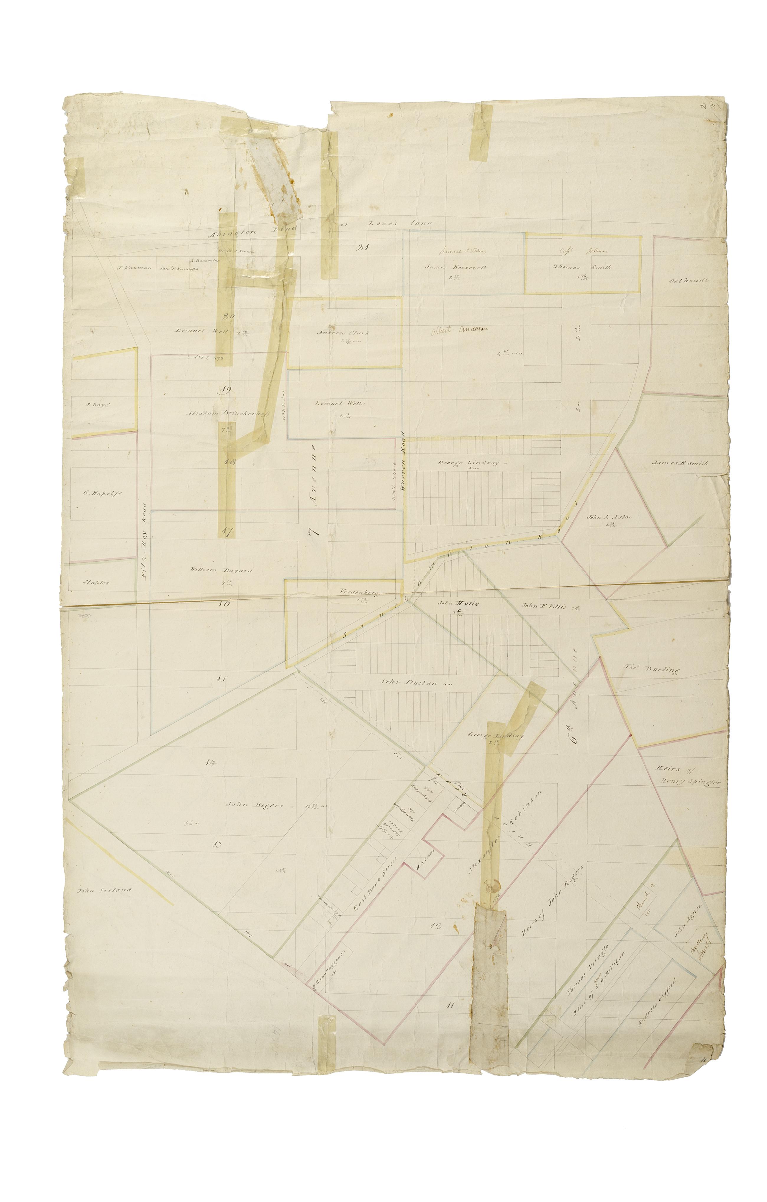
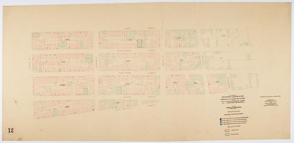
Still Image [Map of the area later bounded by 10th and 21st Streets, 3rd and 6th Avenues, Manhattan, New York, N.Y.]. Scale [ca. 1:2,450]. Cadastral map. Shows property lines and owners' names, some existing roads and projected streets. Shows relief by hachures. Pen-and-ink, watercolor on paper. Annotations in a later hand on the recto of this sheet give the number 1. The map on recto of this sheet belongs to the same series and is separately cataloged under the title, [Map of the area later bounded by 73rd and 94th Streets, Park Avenue and Central Park West, Manhattan, New York, N.Y.]. View Item
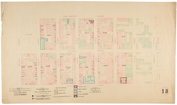
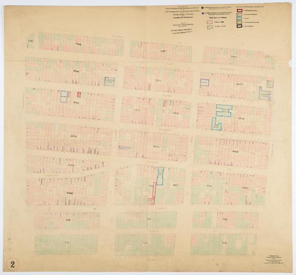
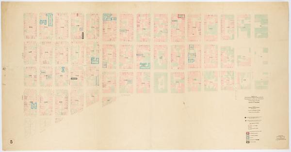
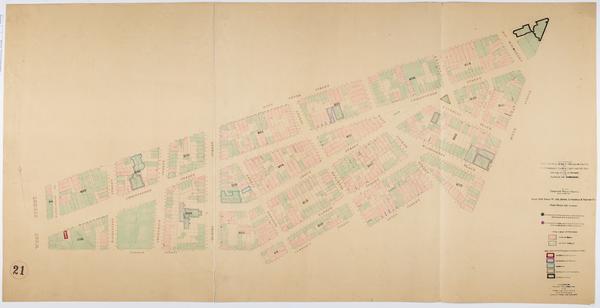
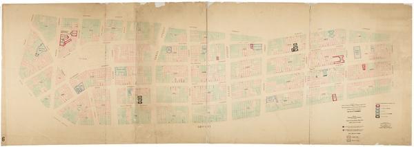
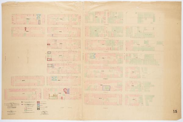
Still Image Map showing over-crowding of the buildings on the lots and the consequent lack of light and air space also strong-holds of poverty and agencies for betterment in the tenement house district bounded by East Houston, Rivington Streets, Willett Street, East Scale [ca. 1:650]. View Item
Still Image Map showing over-crowding of the buildings on the lots and the consequent lack of light and air space also strong-holds of poverty and agencies for betterment in the tenement house district bounded by 17th Street, 12th Street, 3rd Avenue, Avenue A / prepa Scale [ca. 1:650]. View Item
Still Image Map showing over-crowding of the buildings on the lots and the consequent lack of light and air space also strong-holds of poverty and agencies for betterment in the tenement house district bounded by 5th Street, East Houston Street, Bowery, Avenue B / pr Scale [ca. 1:650]. View Item
Still Image Map showing over-crowding of the buildings on the lots and the consequent lack of light and air space also strong-holds of poverty and agencies for betterment in the tenement house district bounded by West 12th & Bank Streets, W. 10th Street, West Street, Scale [ca. 1:650]. View Item
Still Image Map showing over-crowding of the buildings on the lots and the consequent lack of light and air space also strong-holds of poverty and agencies for betterment in the tenement house district bounded by 5th Street, East Houston Street, Avenue B, East River Scale [ca. 1:650]. View Item
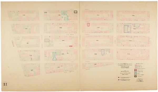
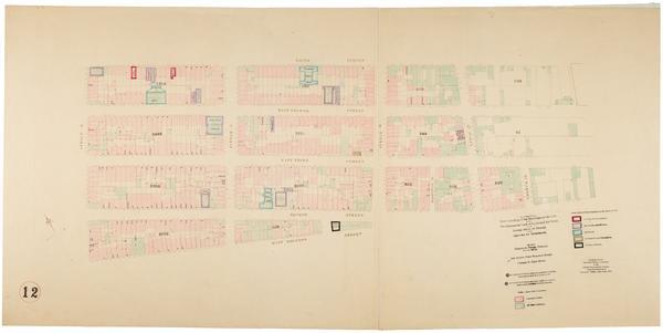
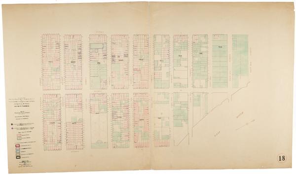
Still Image Map showing over-crowding of the buildings on the lots and the consequent lack of light and air space also strong-holds of poverty and agencies for betterment in the tenement house district bounded by Division Street, East River, Rutgers, Corlears Street Scale [ca. 1:650]. View Item
Still Image Map showing over-crowding of the buildings on the lots and the consequent lack of light and air space also strong-holds of poverty and agencies for betterment in the tenement house district bounded by Cedar Street, Battery Place, West, Greenwich Streets / Scale [ca. 1:650]. Oriented with north to right of sheet. View Item
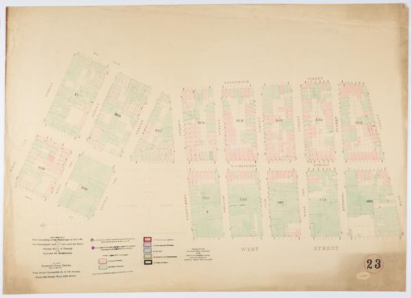
Still Image Map showing over-crowding of the buildings on the lots and the consequent lack of light and air space also strong-holds of poverty and agencies for betterment in the tenement house district bounded by West Street, Greenwich St. & 9th Avenue, West 14th Str Scale [ca. 1:650]. Oriented with north to left of sheet. View Item
Still Image Map showing over-crowding of the buildings on the lots and the consequent lack of light and air space also strong-holds of poverty and agencies for betterment in the tenement house district bounded by Division Street, East River, Catharine, Rutgers Street Scale [ca. 1:650]. View Item
Still Image Map showing over-crowding of the buildings on the lots and the consequent lack of light and air space also strong-holds of poverty and agencies for betterment in the tenement house district bounded by West 4th, Jones, Commerce & Barrow Streets, W. Houston Scale [ca. 1:650]. View Item
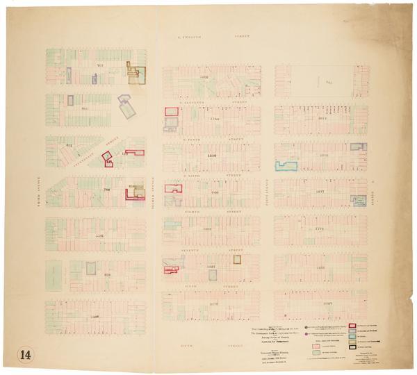
Still Image Map showing over-crowding of the buildings on the lots and the consequent lack of light and air space also strong-holds of poverty and agencies for betterment in the tenement house district bounded by 12th Street, 5th Street, 3rd Avenue, Avenue A / prepar Scale [ca. 1:650]. View Item
Still Image Map showing over-crowding of the buildings on the lots and the consequent lack of light and air space also strong-holds of poverty and agencies for betterment in the tenement house district bounded by West 14th Street, Bank St. & West 12th Street, Greenwi Scale [ca. 1:650]. View Item
Still Image Map showing over-crowding of the buildings on the lots and the consequent lack of light and air space also strong-holds of poverty and agencies for betterment in the tenement house district bounded by Division, Rivington Streets, Essex Street, East River Scale [ca. 1:650]. Oriented with north to the upper right of sheet. View Item
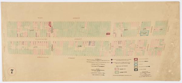
Still Image Map showing over-crowding of the buildings on the lots and the consequent lack of light and air space also strong-holds of poverty and agencies for betterment in the tenement house district bounded by West 10th Street, W. 4th, Jones, Commerce & Barrow Str Scale [ca. 1:650]. View Item
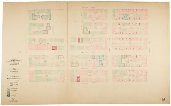
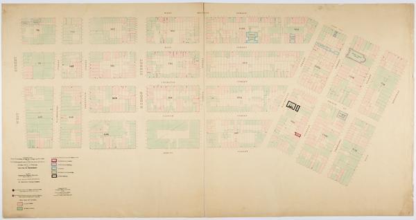
Still Image Map showing over-crowding of the buildings on the lots and the consequent lack of light and air space also strong-holds of poverty and agencies for betterment in the tenement house district bounded by East Houston Street, Park Row, Centre Street, Bowery / Scale [ca. 1:650]. View Item
Still Image Map showing over-crowding of the buildings on the lots and the consequent lack of light and air space also strong-holds of poverty and agencies for betterment in the tenement house district bounded by 12th Street, 5th Street, Avenue A, East River / prepar Scale [ca. 1:650]. View Item
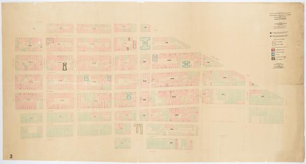
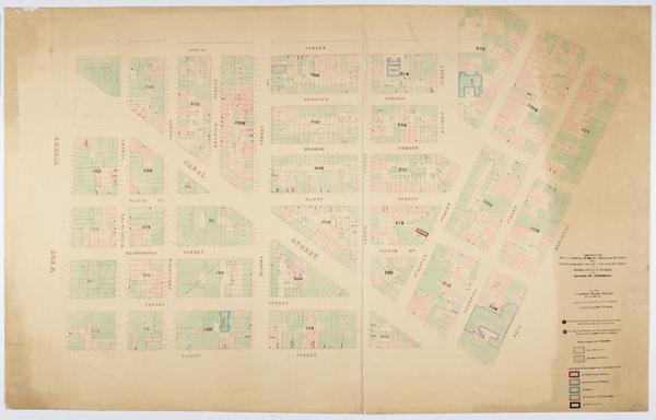
Still Image Map showing over-crowding of the buildings on the lots and the consequent lack of light and air space also strong-holds of poverty and agencies for betterment in the tenement house district bounded by West Street, West Broadway, W. Houston, Spring Streets Scale [ca. 1:650]. View Item
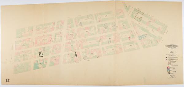
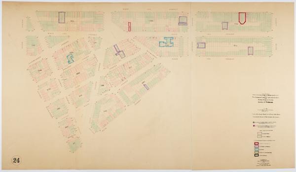
Still Image Map showing over-crowding of the buildings on the lots and the consequent lack of light and air space also strong-holds of poverty and agencies for betterment in the tenement house district bounded by 22nd Street, 12th Street, Avenue A, Avenue C / prepare Scale [ca. 1:650]. Oriented with north to the upper right of sheet. View Item
Still Image Map showing over-crowding of the buildings on the lots and the consequent lack of light and air space also strong-holds of poverty and agencies for betterment in the tenement house district bounded by 17th Street, 12th Street, Avenue C, East River / prepa Scale [ca. 1:650]. Oriented with north to bottom of sheet. View Item
Still Image Map showing over-crowding of the buildings on the lots and the consequent lack of light and air space also strong-holds of poverty and agencies for betterment in the tenement house district bounded by West Street, West Broadway, Spring, Laight Streets / p Scale [ca. 1:650]. View Item
Still Image Map showing over-crowding of the buildings on the lots and the consequent lack of light and air space also strong-holds of poverty and agencies for betterment in the tenement house district bounded by East Houston, Rivington Streets, Bowery, Willett Stree Scale [ca. 1:650]. View Item
Still Image Map showing over-crowding of buildings on lots and consequent lack of light and air space also the prevalence of tuberculosis, typhoid fever, scarlet fever and diphtheria in the tenement house district bounded by Avenue B, East River, 5th Street, East Hou Scale [ca. 1:650] View Item
Still Image Map showing over-crowding of buildings on lots and consequent lack of light and air space also the prevalence of tuberculosis, typhoid fever, scarlet fever and diphtheria in the tenement house district bounded by West Street, 6th Avenue, West 12th & Bank Scale [ca. 1:650] View Item
Still Image Map showing over-crowding of buildings on lots and consequent lack of light and air space also the prevalence of tuberculosis, typhoid fever, scarlet fever and diphtheria in the tenement house district bounded by Bowery, Willett Street, East Houston, Rivi Scale [ca. 1:650] View Item
Still Image Map showing over-crowding of buildings on lots and consequent lack of light and air space also the prevalence of tuberculosis, typhoid fever, scarlet fever and diphtheria in the tenement house district bounded by Avenue A, East River, 12th Street, 5th Str Scale [ca. 1:650] View Item
Still Image Map showing over-crowding of buildings on lots and consequent lack of light and air space also the prevalence of tuberculosis, typhoid fever, scarlet fever and diphtheria in the tenement house district bounded by Avenue A, Avenue C, 22nd Street, 12th Stre Scale [ca. 1:650]. Oriented with north to upper right of sheet. View Item