


Cartographic
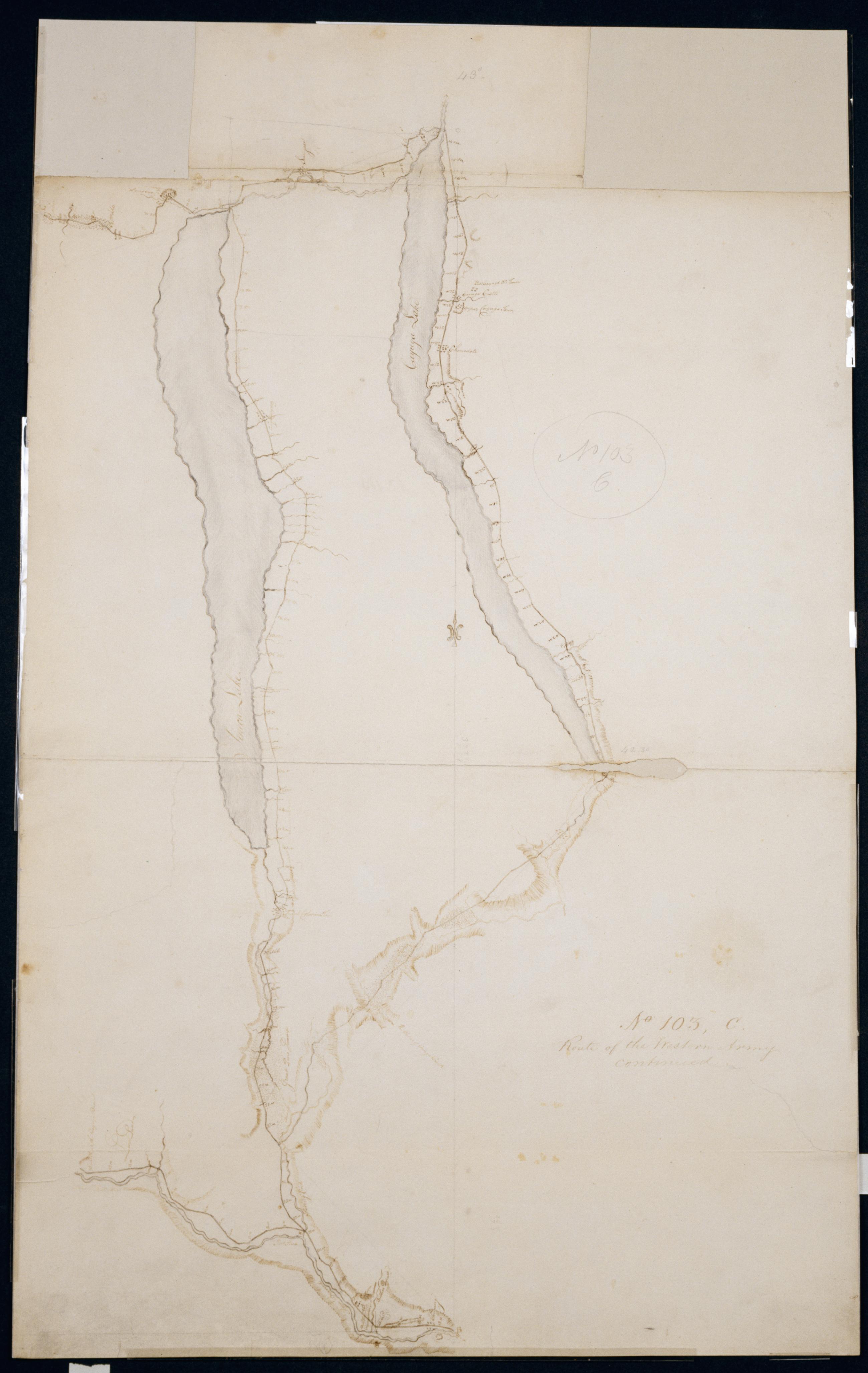
Route of the Western Army continued. No. 103 C / by Lt. Lodge ; by Robert Erskine F.R.S. Geogr. A. U.S. and Assistants.
Creased- soiled- stained- frayed and abraded. Mounted on cloth- bound and cropped- disbound and silked by subsequent owners. Cleaned after removal of cloth backings 1999; paper backing remains. Sheathed in mylar. Imperfect: lacking 2 x 8 cm. at center left of map. In ink on verso "C No. 103" "No. 103". In pencil on recto: "No 103 C". Military topographic map. Covers the counties of Chemung- Schuyler- Yates- Ontario- Tompkins- Cayuga and Seneca in New York. Also shows landforms and streams. Pen-and-ink- pencil on laid paper. Shows relief by hachures.
View Item
