Cartographic
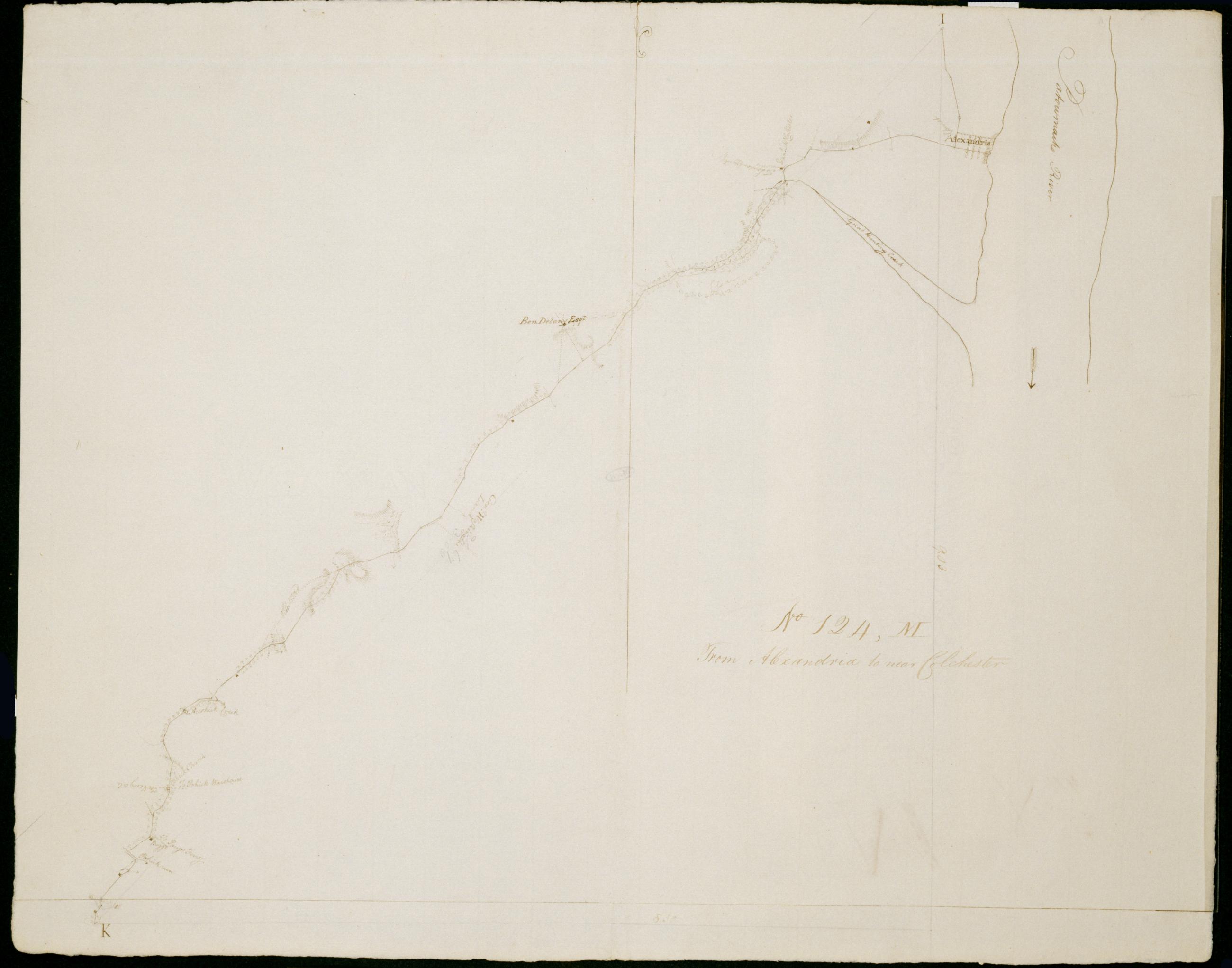
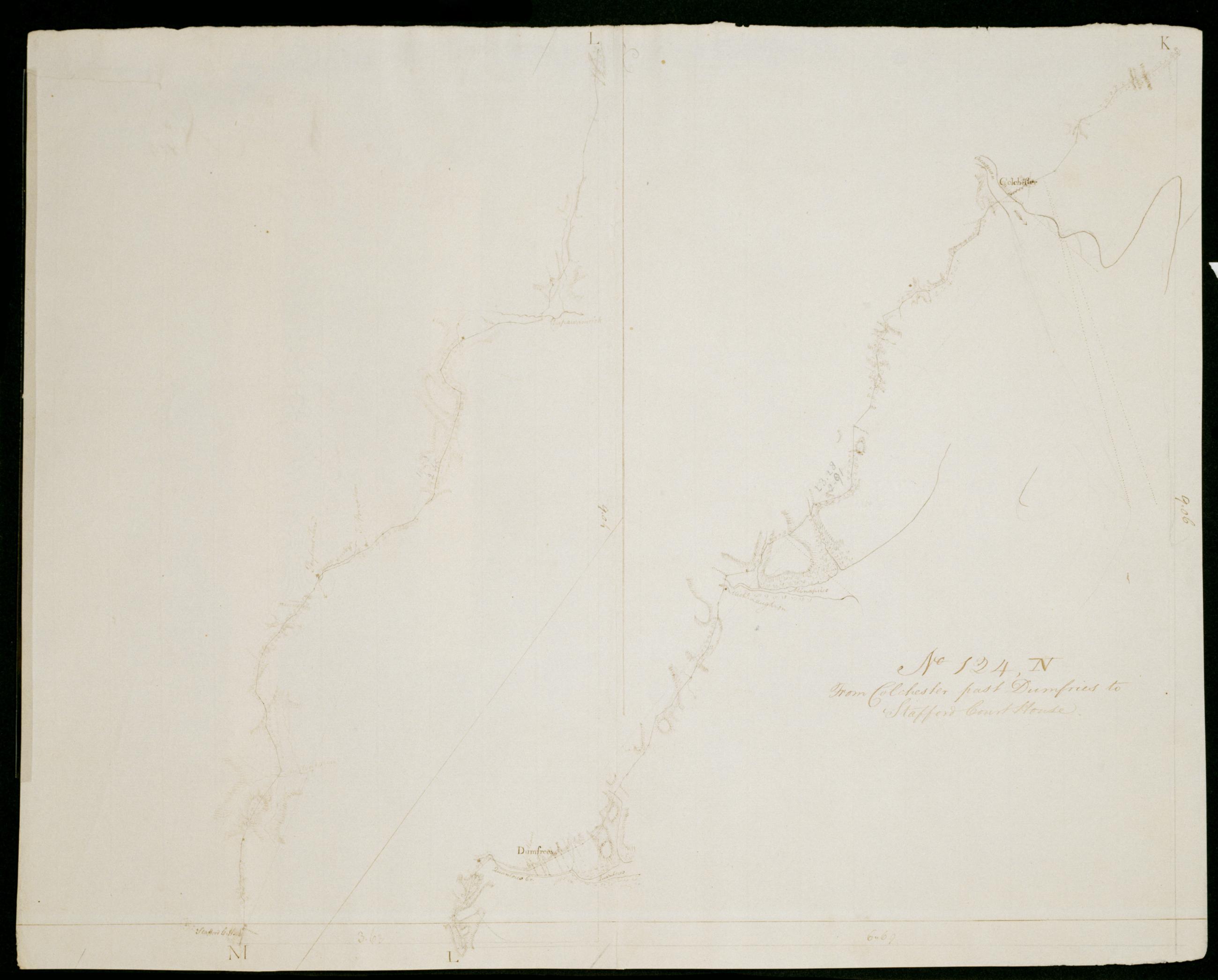
From Alexandria to near Colchester. No 124 M / by Robert Erskine F.R.S. Geogr. A. U.S. and Assistants.
Date 1781 inferred by cataloger. Military topographic map. Covers the city of Alexandria and the counties of Arlington- Fairfax and Prince William in Virginia. Shows roads running through Arlington- Alexandria- Hayfield and Pohick. Also shows buildings- landforms and streams. Pen-and-ink- pencil on laid paper. Shows relief by hachures. Soiled- creased and abraded. Mounted on cloth- bound and cropped- disbound and silked by subsequent owners. Cleaned after removal of backings 1999; some fill remains. Sheathed in mylar.
View Item