


Cartographic
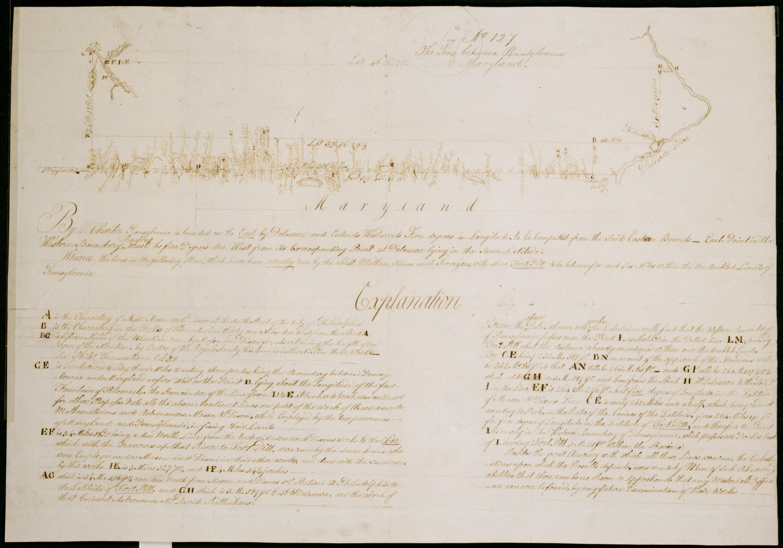
The Line between Pennsylvania & Maryland. No 127 / by Robert Erskine F.R.S. Geogr. A. U.S. and Assistants.
Date of situation ca. 1772--cf. Hindle- Brooke. David Rittenhouse. Princeton: 1964- p. 92ff. In pencil on recto: "No 127". Military topographic map. Map also shows that Fort Pitt is within the western boundary of Pennsylvania. Shows landforms and streams intersecting the southern but not the western border. Pen-and-ink- pencil on laid paper. Shows relief by hachures. Soiled- creased and abraded. Mounted on cloth- bound and cropped- disbound and silked by subsequent owners. Cleaned after removal of backings 1999; some fill remains. Sheathed in mylar.
View Item
