Cartographic
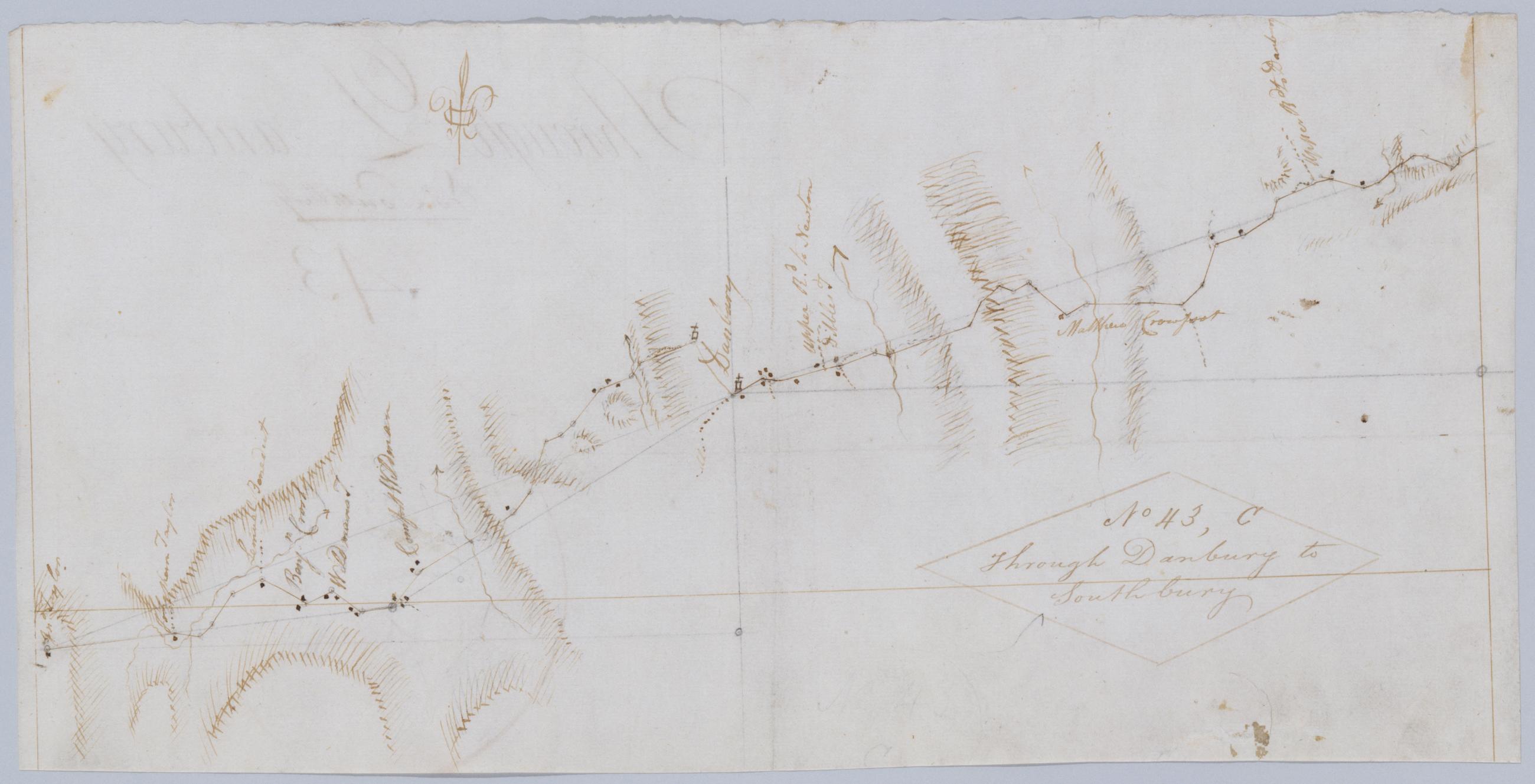
Through Danbury to Southbury. No 43 C / by Robert Erskine F.R.S. Geogr. A. U.S. and Assistants.
Foxed- creased- frayed- and abraded. Mounted on cloth- bound and cropped- disbound and silked by subsequent owners. Cleaned after removal of backings 1999; some fill remains. Sheathed in mylar. Military topographic map. Covers the townships of Bethel- Danbury and Ridgefield in Fairfield County- Connecticut. Shows roads running through East Danbury and Danbury. Also shows buildings and owners' names- landforms and streams. Pen-and-ink- pencil on laid paper. Shows relief by hachures. Title proper from recto is the work of a later editor--Simeon DeWitt or his assign--subsequent to 1820.
View Item