


Cartographic
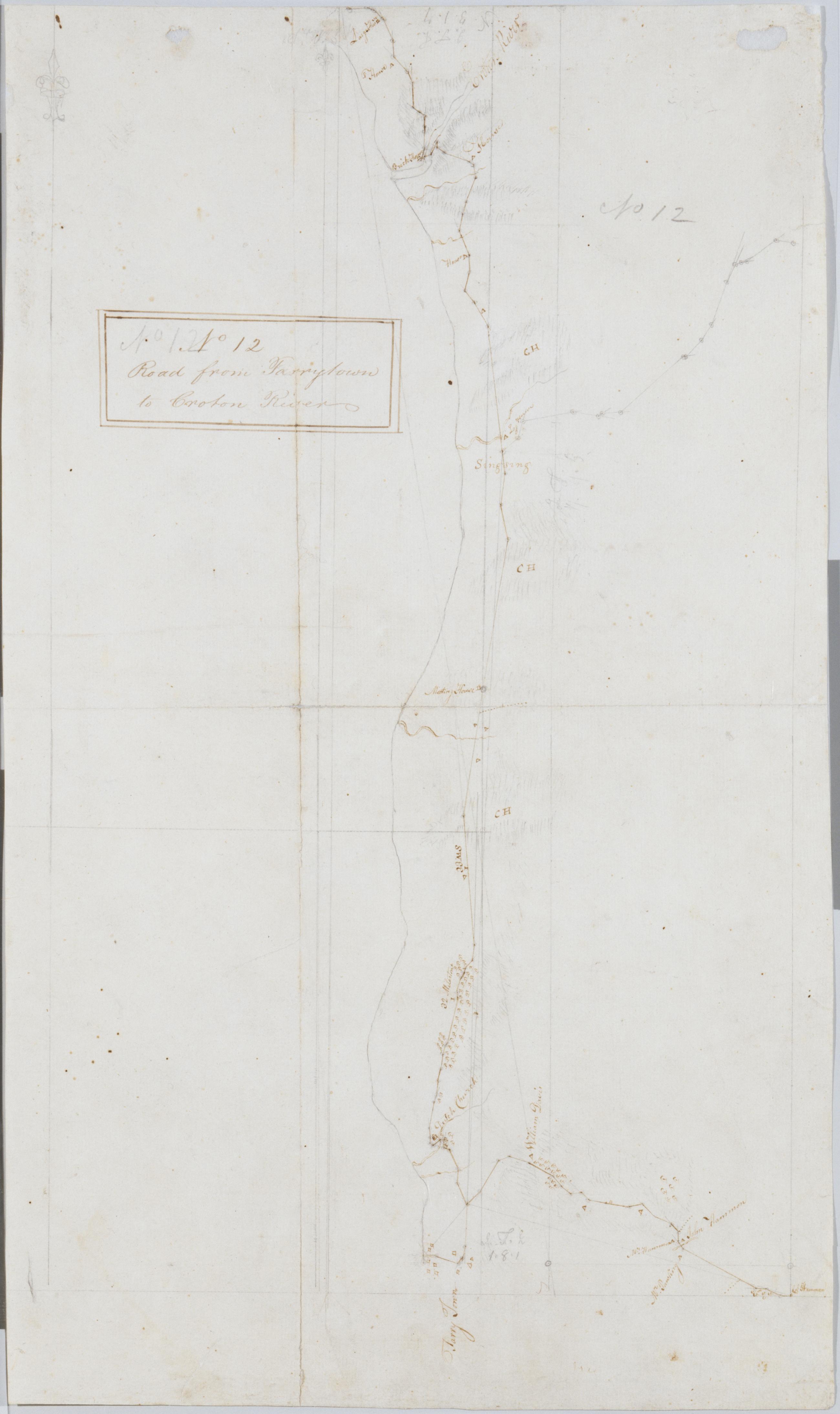
Road from Tarrytown to Croton River. No 12 / by Robert Erskine F.R.S. Geogr. A. U.S. and Assistants.
Foxed- creased- frayed and abraded. Mounted on cloth- bound and cropped- disbound and silked by subsequent owners. Cleaned after removal of backings 1999; some fill remains. Sheathed in mylar. Military topographic map. Covers the towns of Mt. Pleasant- Ossining and Cortlandt on the left bank of the Hudson River in Westchester County- New York. Shows roads running through Eastview- Tarrytown- Ossining and Croton. Also shows buildings and owners' names- landforms and streams. Pen-and-ink- pencil on laid paper. Shows relief by hachures.
View Item
